Long and very varied circuit to discover the Najac countryside. Natural and architectural curiosities as well as beautiful viewpoints. A few passages on the road. Possible variant for a circuit of 2h30 instead of 6h.
Start of the hike opposite the entrance to Camping le Païsserrou, on the bottom of Najac. Possibility to park 200 meters further in the parking lot of the outdoor base (AAGAC).
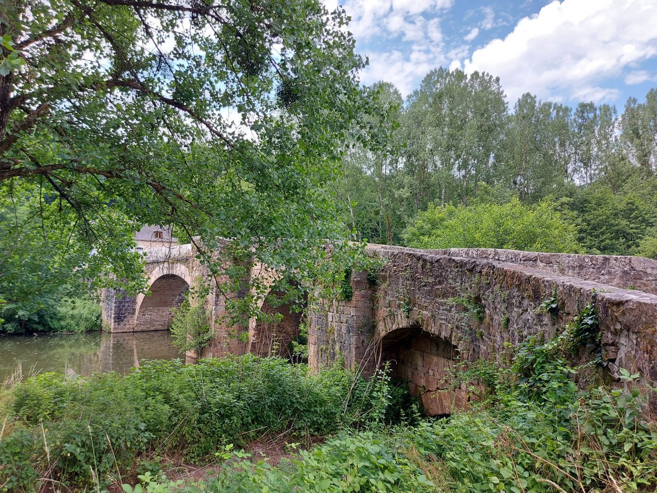
Descend towards the river for 150 meters along the D39 then cross the Frégère bridge. Take the path that descends to the left at the exit of the bridge.
Along the Aveyron to the municipal swimming pool. Continue along the river on the road to the St Blaise bridge.
Step 2: Step 1
Rens Kokke/Flickr
Do not cross the bridge, take the small road on the right which goes up towards Les Fieys for 200 metres.
Take the wide path to the right. Stay on this path for 2,5 km to the road (a place called La Crouzille).
Take the D564 which climbs towards Villevayre for 200 meters then take the path on the right which leads to one of the most beautiful viewpoints over Najac!
Step 3: Step 2
Cross the road and take the path opposite. (Possibility of variant by continuing on the road). The path climbs towards the place called La Barthe. Arrived at the small road, turn right for 200 meters.
[Junction with circuit 9 possible by taking the road to the left]
Step 4: Step 3
Cross the D47, admire the cross and the landscape. You are at the highest point of the hike.
Take the road opposite which descends then turn left to take the wide path. Leave a first path on the left then turn right at the Y.
Continue on the wide path for 600 meters then take the path on the right which descends. Arrived at the small hamlet "La Bouyerie", take the road on the right then the path immediately on the left.
At the next intersection, turn right and take the road for 150 meters. Turn left on the path then immediately right on the small path. You descend for 2 km sometimes on limestone slabs, sometimes between the box trees to the Baye stream.
Step 5: Step 4
Turn right without crossing the stream, the path goes deeper and deeper into the valley of the Baye. (Optional, possibility of joining from point 4 the chapel of St Eutrope 15 minutes away).
Step 6: Step 5
You arrive at an old quarry where you can still see the traces of the extractions of the sandstone millstones used in the past for the use of the mills.
Cross the Baye, take the steep path to the right. This path runs along the stream in a magnificent setting.
You will come across a first ruined mill, continue straight ahead to reach the Prat Ferrand mill. Turn right to climb towards the hamlet of Villevayre.
At the last hairpin of your ascent, a round trip to a small cave is possible by taking the path to the right for 100 meters, otherwise continue to Villevayre
Step 7: Step 6
OT Najac
Cross the village and continue straight on the road towards Villefranche/Najac.
Cross a first hamlet turning to your left at the crossing with the small cross then continue on the road to Baussaguet.
In Baussaguet take a slight right and continue the road for 300 meters, pass in front of the stone cross and 50 meters further turn on your right. The path climbs to the edge of meadows to a place called "Le Ligal".
Step 8: Step 7
At the level of the road, turn right then immediately left on the forest track which descends towards Najac. Follow the markings all along the forest track which leads you to the road. Turn left as far as the St Blaise bridge, then turn sharp left to follow the river on the way back to your starting point.